In which Sid and Doris have a fabulous long ride clear across the Causses de Cevennes and a good way along the Tarn.
Last night there was an excellent storm with big rain, lightning and long-rumbling thunder. Today started cold, we wore windproofs to set off. This is the first cool day we have had since… Hungary? Bulgaria? At least two months of over 30’C cycling and now our blood has thinned.

 We were a bit daunted with the 108 kilometres we had set ourselves. The route is all small roads, though much written up as great tourist trails. La Couvertoirade and the Larzac Causse feature in all the puffery for the area. Mostly it is a very empty zone on a high limestone plateau where only sheep and a few Dutch tourists grow.

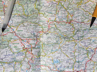
Here is a picture of the map and route across the Causses, then down the river valleys through tiny hamlets to Ambialet, itself with a population of 450. To follow the route start where the pencil points to Saucliere. Go west to Junction 48 and then go north up the old road to L’Hospitalet before heading for Viala, St Affrique, along the Dourdou valley to Broussard Le Chateau, then the white roads along the north bank of the Tarn. It is a lovely route and thanks to a change in the weather we are riding in warm sunshine, with a refreshing (if annoying) headwind.
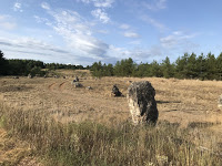
At L’Hospitalet du Larzac we find a set of unexplained standing stones. Could have been raised by 20th century Druid wannabes or there for ever. Maybe they are unexplained because nobody understands them – and frankly, the stones don’t care. Echos of Alan Garner books from Doris’ childhood.
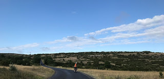
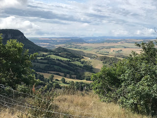
The picture from Saint Eulalie de Cernon tries to give some idea of the scale, scrubby vegetation and rugged terrain, and the second picture is as we drop off the edge of the causse down to Tournemire.
For the sheep there are drinking ponds. For the tourists almost nothing, as we find when we try for a cafe in Tournemire. It is shut. We buy first lunch in a Votre Marche and eat it in the village recreation ground. Still, the shop was better stocked than we found in Bulgaria.
The first real town is Saint Affrique where we bought second lunch to eat further down the road. This was a simple precaution as Doris hopefully predicted tourists and cafes in the villages along the rivers that mark our route.
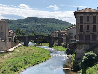
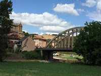
There are no cafes, second lunch is eaten at the Camping Municipale in Saint Izaire, where Sid sees one of his favourite 1940s concrete bridges.
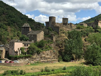
We pass Brousse le Chateau and there are a few tourists visiting. Alas we are still some way from home and so simply take the #bestviewedfrombelow picture.
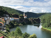

The road along the Tarn is a railway line that has been turned into a road. This is not a bike path, it is the road now. For us this is great because railway lines have bridges, embankments and tunnels to keep them flat. We are not allowed into some of the longer tunnels (up to 500 meters) but are permitted in others. We use them all with Sid’s gloom buster light pointing up the worst of the pot holes. Even at Ambialet we still have the rail/road with us. This is the view from our Hotel terrace; you can see the influence of the railway on the tunnel at the other end of the bridge. This was a road tunnel and bridge combination built 1897 to 1902. Sid will try to look out the history of the line and its conversion.
Ambialet is on a 3.5k meander in the Tarn, almost an island. There are some things to see and we can rent kayaks. It is time for a small holiday.