I thought you might like to see some of the information I have at my fingertips when cycling along.
 I have the iPhone running RideWithGPS on a Quadlock mount on the handlebars, and with the merest brush of a finger (or an irritable series of prods when it is raining and all my fingerprints have gone wrinkly and are no longer recognised) I can see where we are and what lies ahead of us.
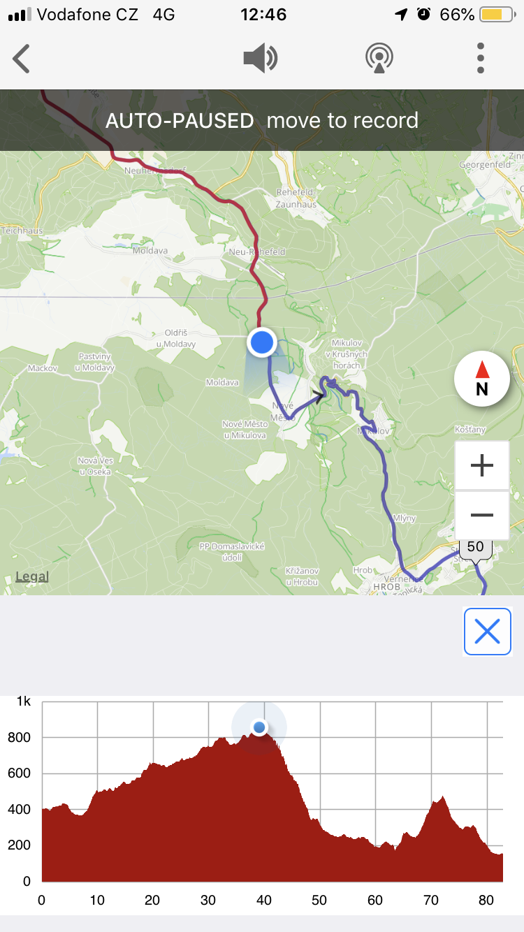
Here’s the screen as we are going across the German/Czech border – the blue blob is us, the red trail is where we’ve been and the blue wiggles show the shape of the steep downhill ahead of us.
At the bottom is the profile of the ride showing that we’ve just done most of the day’s climb, we’re going to spend the next 10km going vertically downwards and then there’s a bit of a nasty few km before the end.
I should tell you that the vertical scale is always about 1″ tall, so even in the Netherlands it looked pretty lumpy.
Other displays show you the total climb and how much you’ve done of it – we are aiming to keep to a max of 1,000m up if we can, but today was 1,150ish.
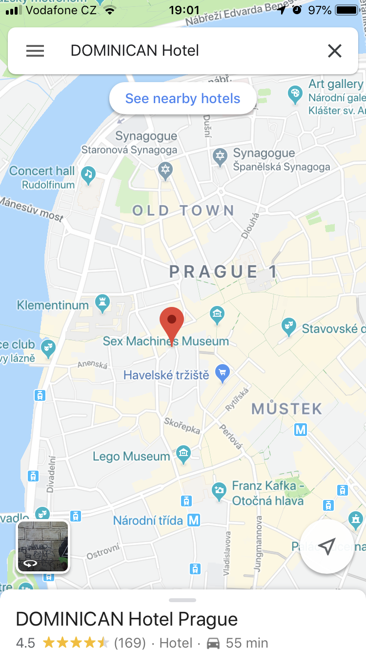 Oh, I thought you might also be amused by this screen shot of our hotel tomorrow. You can see it is handily placed between the “Sex Machines Museum” a little way to the north-east, and the “Lego Museum” to the south.
The mind boggles. I mean… no, just don’t go there.
Yes. Don't.