You will be amazed at how things have come on since our Istanbul trip 5 years ago. Or not.
The outbound part of the Istanbul trip broadly divided into three parts, from a navigational point of view:
- Netherlands and Germany – bike-friendly countries where you select “bicycle” on Mr Google you are guaranteed at least a bike lane and more commonly a specially-built track
- Following the somewhat erratically-marked Danube Cycle Trail, where the big challenge was to find the path
- Making our way through Bulgaria and Turkey, where there weren’t many roads and so navigation was easy although survival sometimes wasn’t.
Since then we have been using various bits of route-planning software to try and select roads which are reasonably quiet but still get us broadly in the direction we want. Mr Google has developed a bit of an obsession with bridleways – in the UK rights-of-way system these are unpaved paths which can be used by bicycles but more often, especially in wet weather, by horses. Quagmires result but Mr Google is convinced that our narrow-tyred grit-hating delicate little road bikes can simply waft over them.
So the “bicycle” option on Mr G is out, and the “driving” option tends to favour major A roads. Not so good.
Other options we are trying include:
- brouter.de which allows you to enter statistics for how grossly unfit you are and then calculates the best route;
- ridewithgps which is brilliant at reading out the route while you are cycling and showing you the hills to come but a little bit erratic at choosing the route;
- cycle.travel which is the inverse of ridewithgps;
- viamichelin which is the only one I’ve found so far with halfway decent mapping, showing you the difference between a big road and a little road EVEN for the one it is routing you down (none of the others do that).
The method so far is: design route with cycle.travel. Admire possible alternatives with viamichelin. Run route on the day with ridewithgps and pause every so often to consider alternatives when cycle.travel has, on an inexplicable whim, routed us down a footpath round a playing field.
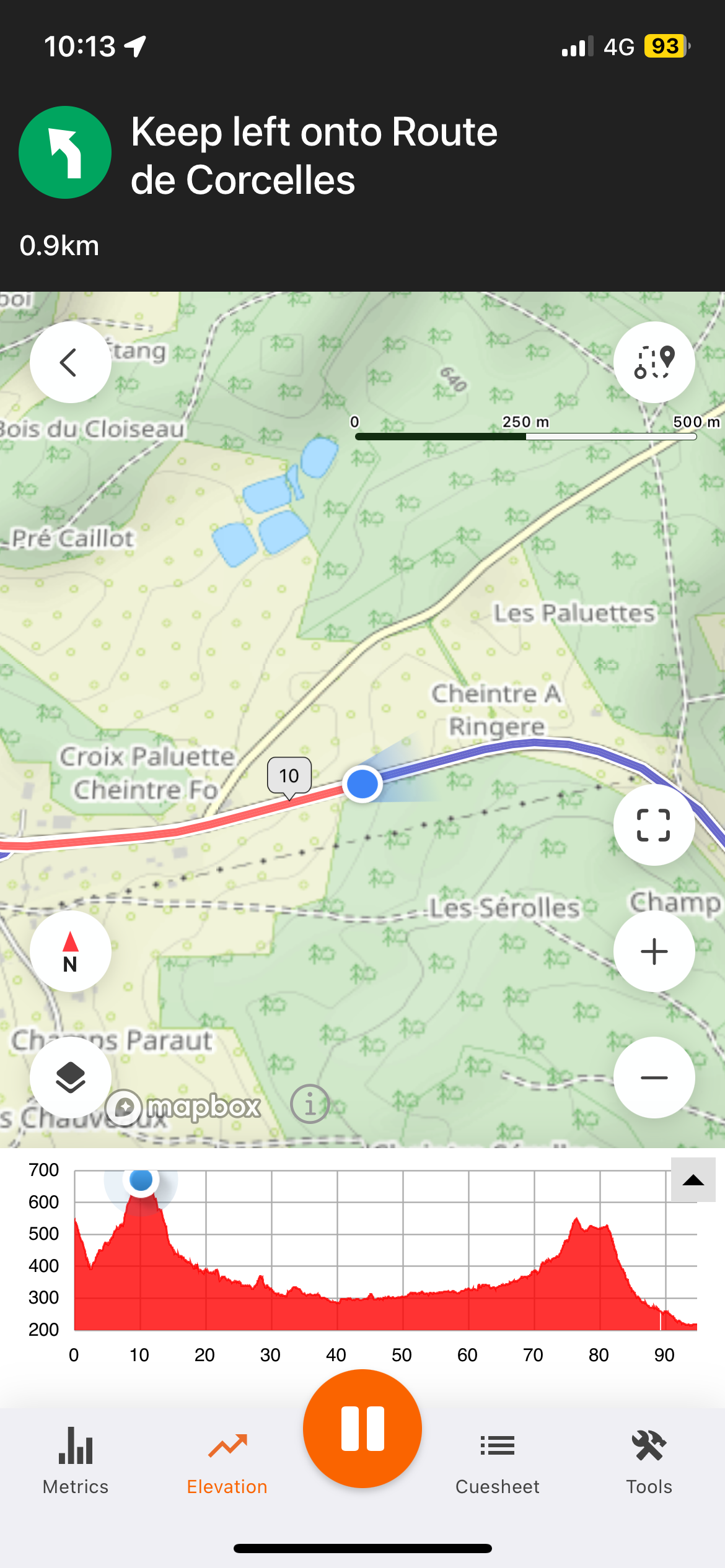
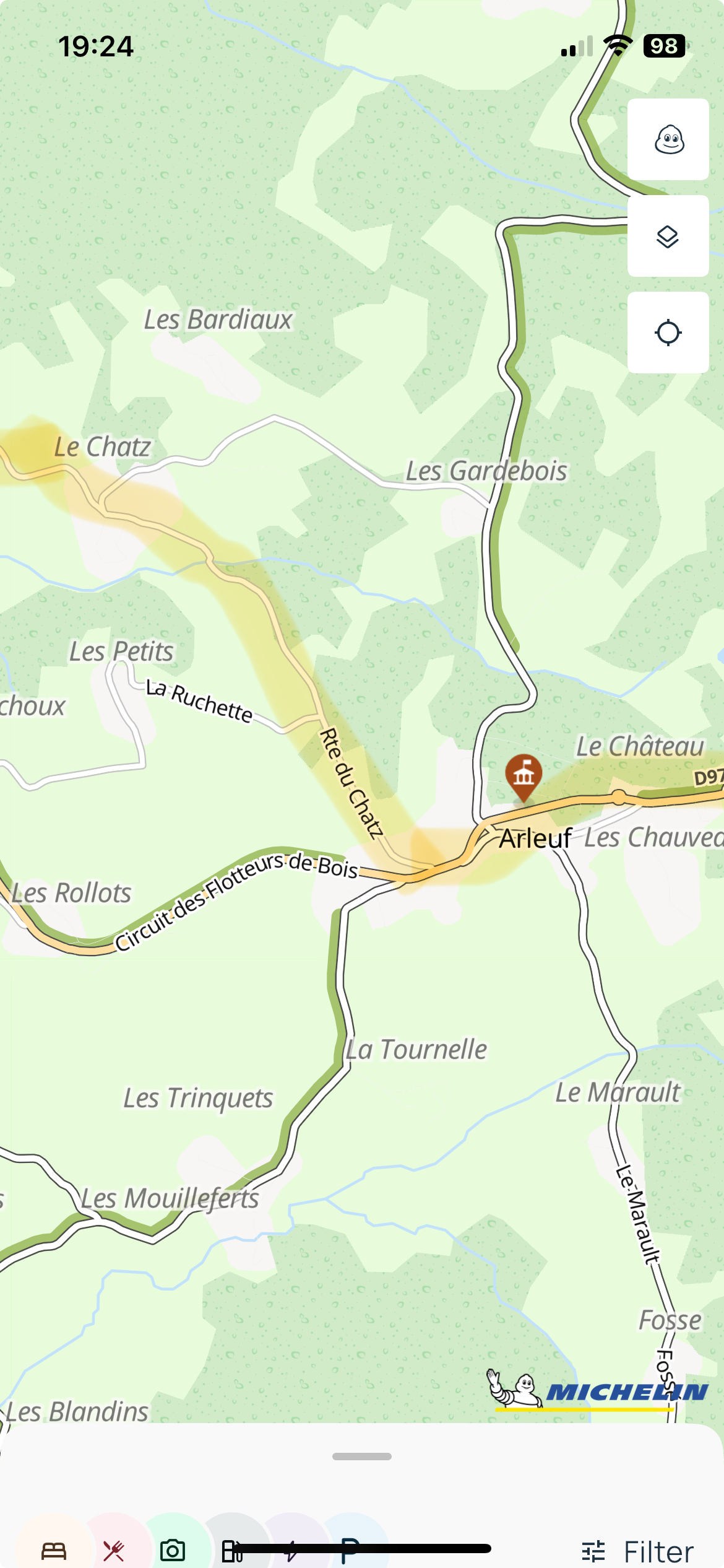
Here are two phone screenshots – the first is a live picture from ridewithgps showing exactly how high we had climbed, and the second is my mock-up of how you could show the route while still showing all the underlying detail.
I need to take more care not to cycle into enormous holes while poking irritably at the phone. Please feel free to reply to this with your views on amazing cycle routing and navigation sites.